Geology und Geography of the Chang Tang
The region of the Chang Tang covers an area of about 1.2 million square kilometers. The rocks on the surface of the Chang Tang plateau, which used to be a sea floor, are metamorph sediments, often folded in crazy structures.
The Chang Tang forms its own small tectonic plate and was lifted uniformly to an average altitude of about 4900 m when the Indian subcontinent collided with Asia. Therefore, the Chang Tang region is characterized by wide open plains and the central Chang Tang has no river drainage. From the wide plains of the Chang Tang, several high peaks with altitudes above 6000 m emerge like islands.
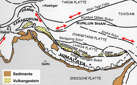 Tectonic
map of the Tibetan high plaeau. Red arrows indicate movement of tectonic
plates along the faults (black lines). The Tibetan borders of the Tibetan
high plateau are among the highly active earth quake zones of the world.
Tectonic
map of the Tibetan high plaeau. Red arrows indicate movement of tectonic
plates along the faults (black lines). The Tibetan borders of the Tibetan
high plateau are among the highly active earth quake zones of the world.
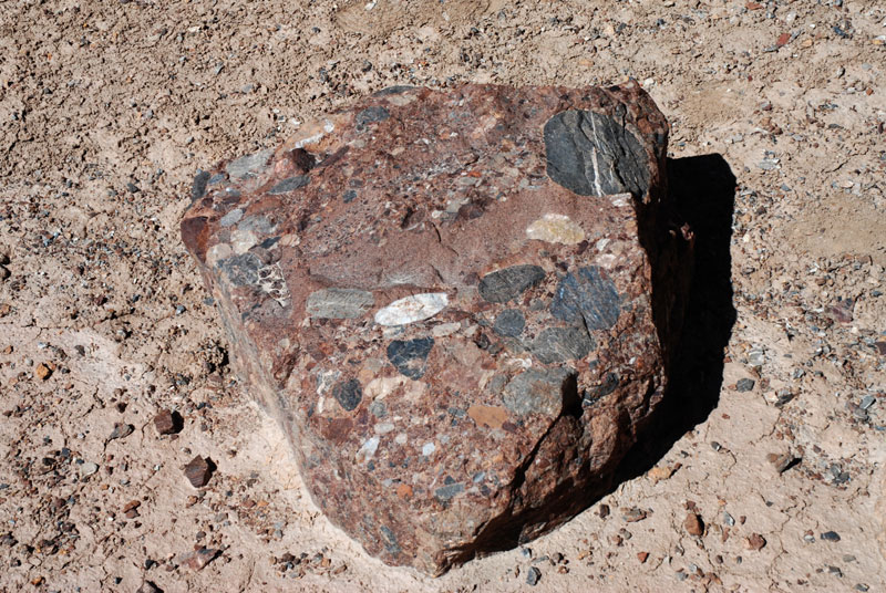 Metamorphic rock: Breccia . |
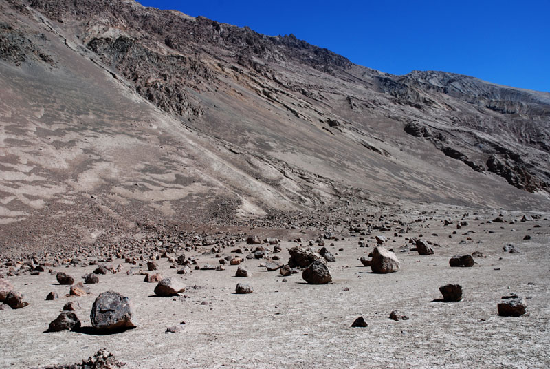 Big fallen rocks at the base of a long gravel slope. |
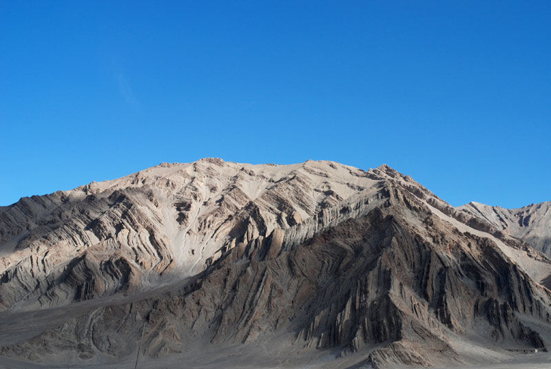 Bizarre and vertically folded sediment layers. |
Chang Tang Info
Geologie / Geographie
Wie entstand das Chang Tang? Hintergrund-Information zu Geologie und Geographie. Weiter…
Tierwelt
Trotz der Kargheit, birgt das Chang Tang hat eine vielfältige Fauna. Weiter…
Pflanzenwelt
Die Pflanzen müssen sich an eine kurze Vegetationsperiode und das kalte Klima anpassen. Weiter…
Nomaden
Die einzigen Menschen, die dauerhaft in dem rauen Klima des Chang Tang leben können. Weiter…